Back Heritage » Saigon » [Photos] Rare Aerial Photos Depict the Urban Contours of Saigon in 1950

[Photos] Rare Aerial Photos Depict the Urban Contours of Saigon in 1950

In the French photo book titled Indochine – Couverture. Saigon-Cholon – Photographie Aerienne 1950, a fascinating set of aerial images showcases the urban layout of Saigon in 1950.

In the middle of the 20th century, Saigon wasn’t the massive metropolis it is today, reaching in all directions with its suburban peripherals. Back then, the city was made up of the administrative cerebrum in District 1 and 3, and the bustling trade hub of Cho Lon in District 5 and 6. The rest of the districts as we know now used to be either less-developed transition zones or even straight-up wilderness.

Fly over Saigon via the photos below:

A view of metropolitan Saigon from the Thu Thiem Peninsula.

Tau Hu Canal in District 8.

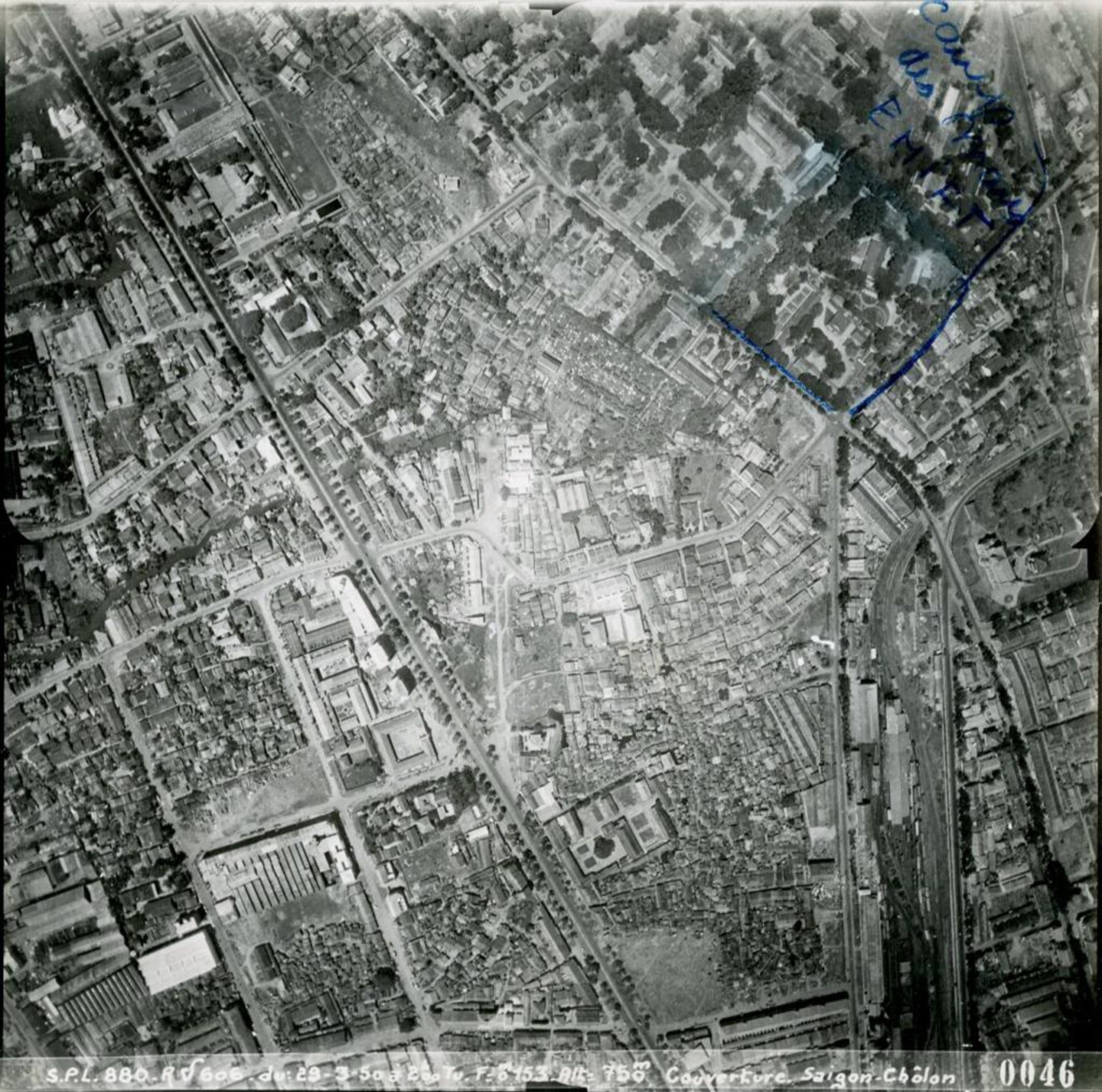
The Phu Dong Roundabout (bottom left) and Cach Mang Thang 8 Street.

Saigon Railway Station.

Turtle Lake.

Ben Thanh Market with the Reunification Palace on the right.

Tan Son Nhat Airport.

The site of today's Hoa Lu Stadium with the Saigon Zoo below.

Where the Thi Nghe Canal meets the Saigon River with the Saigon Zoo in the middle.

The riverside edge of District 1 with the Ba Son Shipyard on the top left.

The Bach Dang Wharf.

Me Linh Square.

Thu Thiem.

District 4 (left) and District 1 (right) connected by the Khanh Hoi Bridge and Mong Bridge.

Ong Lanh Bridge (bottom left).

The Nguyen Kieu Isle (left) used to be separated from District 4. It now serves as the connector of District 1, 4 and 7 via the Nguyen Van Cu Bridge.

The once-riverine District 4.

The Y Bridge under construction (left).

Houses in District 4.

District 1 with the tree-lined Tran Hung Dao Boulevard in the middle.

District 3 with the Do Thanh Residential Enclave in the middle.

Hoa Hung Railway Station on the right.

District 3.

The Phu Tho Racecourse.

[Photos via Redsvn]

Related Articles

in Saigon

[Photos] A Peek Back at Saigon's Enduring Street Vendors in 1950

Where else can you buy whatever you need without having to step inside a building?

in Saigon

From Swampland to Heartland: The History of Bến Thành Market

From the very first discussions in 1868 regarding a new marketplace for Saigon, it was not until 1914, that Bến Thành Market became a reality. The birth of the market was like a dream come true, one t...

in Saigon

[Photos] 10 Black-and-White Images of Saigon in 1970

A trip to Saigon in 1970 by photographer Jerry Bosworth yielded a small cache of black-and-white images that vividly depict a city in flux.

in Hanoi

[Photos] A Game of Trade: Hanoi’s First International Trade Fair Complex

Hanoi has had many names in its life time; among the lesser-known ones is Ke Cho, which literally means "the market people."

in Vietnam

[Photos] Long Xuyen, an Enterprising Mekong Delta Trading Hub in the 1920s

Founded on the banks of the Hau River, Long Xuyen began as a trading post and has prospered into one of the Mekong Delta’s major cities today.

in Saigon

A Brief History of District 1's Collège d’Adran, Saigon's Oldest School

Driving past the Saigon Zoological and Botanical Garden toward Nguyễn Hữu Cảnh Street, many of us might not notice the presence of Võ Trường Toản Secondary School and Trưng Vương High School. The two ...

Partner Content

in Partner Content

The Pizza Industry’s “Steve Jobs” Comes to Vietnam

From a small restaurant with only one oven in the basement of Syktyvkar in Russia's far north, Dodo has become the fastest-growing pizza chain in the world. It now has its sights set on Vietnam.