How often do you think about the Saigon River?
Unless you are driving across it or live within view, perhaps not very often. But the river is not only essential for the entire nation's imports and exports, bringing in many of the goods you encounter every day, but it was an essential element in Saigon's development.
When the French made efforts to transform Saigon from a town into a city during the colonial period, they relied heavily on the river. Because most visitors arrived via the Saigon River, major monuments were placed to be visible from the port, with all major roads leading straight from the river.
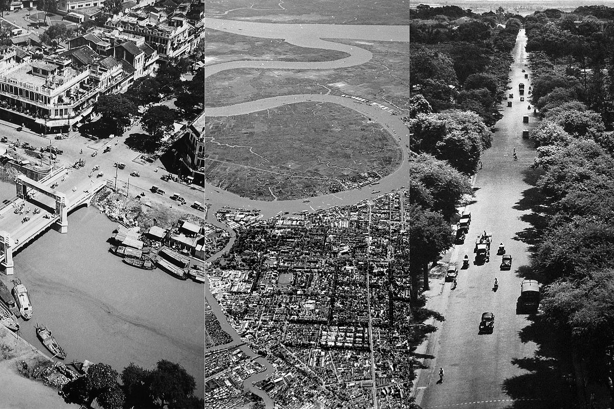
These aerial photos taken in 1950 reveal how massive and beautiful the river is, and also how integral it is to the orientation of Saigon's roads and buildings as part of the meticulously planned and arranged District 1.
Taken by French photographer Raymond Cauchetier, the black and white images also remind viewers how much smaller Saigon was not so long ago. It's hard not to look at the tree-lined streets and long for the days when the city had more greenery and fewer heat-trapping skyscrapers.
Have a peek at the photos below:

Leading towards the Saigon River.

Notre-Dame Cathedral Basilica (sans construction scaffolding).

Bicycles, cars, motorbikes and horse-drawn carriages all travel near Ham Nghi Street to the boats.

Nguyen Hue Street leading from the river.


The Saigon River curving along District 1.

Hai Ba Trung Street.

Dong Khoi Street bathed in shade from trees.

Ships of all sizes on the water and at the wharf.

A good look at District 1's grid-like street layout.

Canals bring the power of the Saigon River deeper into the city.

What is today District 4, across from District 1, was somewhat undeveloped at the time.

A variety of bridges, including the iconic Cầu Mống, span the Ben Nghe Canal.

A jumble of simple structures along the shore catering to the water traffic.

A frenzy of commerce along the Bne Nghe Canal. What is today Vo Van Kiet Avenue is in the upper half of the photo.

A canal flows through the crowded suburbs and towards open fields.

Untrammeled nature rests not far from the city.

The river's curves contrasted by straight roads.

Unmistakable colonial-style structures along a canal.

Cho Lon market was much closer to the fields in the 1950s.

The Saigon River meets the Soai Rap River.

Clouds putting the size of the river in perspective.
[Photos via Flickr user manhhai]


